
|
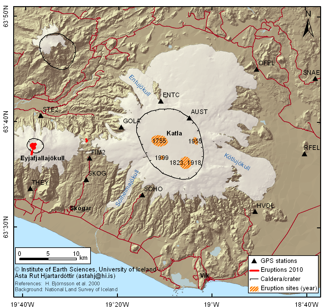
Time series for GPS stations around Katla volcano. The stations named AUST, ENTC, OFEL, RFEL, STE2, FIM2, and SKOG are operated by the Institute of Earth Sciences, University of Iceland, with the support of RANNIS. The stations THEY, SOHO, HVOL, GOLA, and SNAE are operated by the Icelandic Meteorogical Office (IMO).
The data were analyzed at the University of Iceland using the GAMIT/GLOBK analysis software using over 100 global reference stations to determine stations coordinates in the ITRF08 reference frame. Here we show detrended time series for the North, East and Up components (in millimeters). For HVOL, GOLA and SOHO, the time series are detrended using linear and annual terms. For more information contact Sigrun Hreinsdottir, IES Please respect copyright and authorship of the data. |
CLICK on PLOTS for more details
| Godabunga (GOLA) | Enta (ENTA & ENTC) | Austmannsbunga | Fimmvorduhals (FIM2) |  |
 |
 |
 |
Lágu-Hvolar (HVOL) | Rjúpnafell (RFEL) | Öldufell (OFEL) | Snaebýli (SNAE) |  |
 |
 |
 |
| Thorvaldseyri (THEY) | Steinsholt (STEI & STE2) | Sólheimaheidi (SOHO) | Skógaheidi (SKOG) |
 |
 |
 |
 |